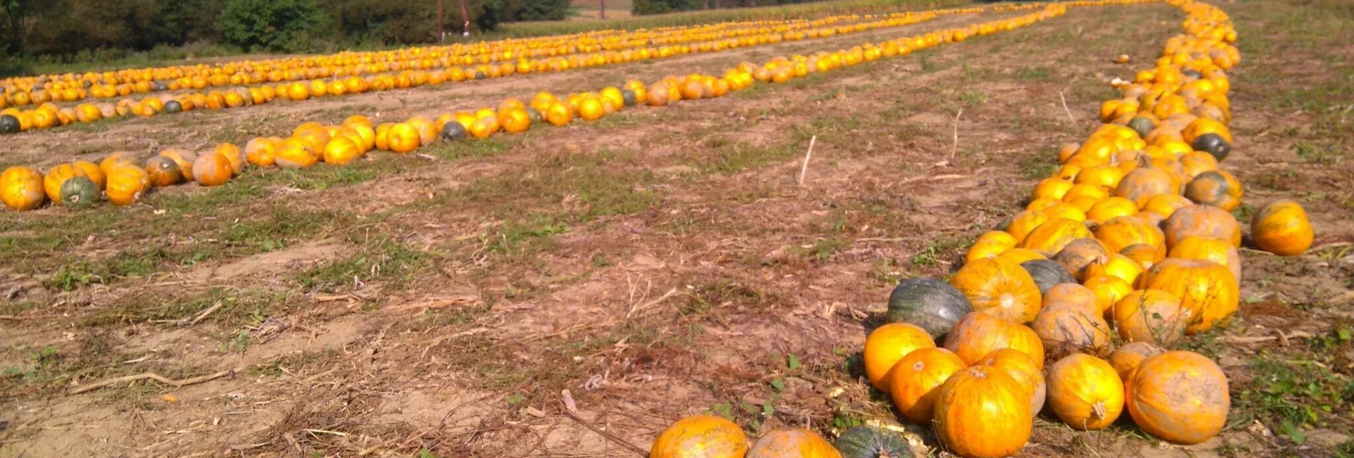

FB2 Kernel oil tour thermal & volcanic land Styria (FB2 Kernöltour Thermen- & Vulkanland Steiermark)
OpenAdditional information
Tourist office Thermen- & Vulkanland
Gästeinfo Feldbach
Hauptplatz 1
8330 Feldbach
feldbach@thermen-vulkanland.at
www.thermen-vulkanland.at
Öffnungszeiten:
Mo-Fr von 9-12 und 13-16 Uhr
Foyer von 6-22 Uhr
Author’s recommendation
Author
Christine Neuhold
Safety guidelines
Emergency call mountain rescue: 140
ambulance: 144
European emergency call: 112
firefighters: 122
police: 133
Tips when reporting an emergency – Answer these six WH questions: What happened? How many people are injured? Where did the accident happen (are there GPS coordinates)? Who is reporting the incident (callback number)? When did the accident happen? What is the weather like at the site of the incident?
Directions
KM Route
0 Feldbach main square / town hall
0,4 Bürgergasse straight ahead
0,5 small Raab bridge straight ahead
0,6 Bahnhofstraße right
1,1 direction Raabau resp. in Raabau straight ahead
5.3 Lödersdorf - road to the right
7.8 Johnsdorf - place name sign straight ahead
8,3 Johnsdorf - village center left
11,0 Road course to the right in the direction of Forchauberg
11,9 hilltop left
12.9 Start of gravel road to KM 13.9
14.2 Riegersburgblick with bench straight ahead STOP
14.4 before Buschenschank Maurer straight ahead
16.5 on B 66 (at Fromagerie) straight ahead
18.0 Zotter Schokoladen straight ahead STOP
18,6 straight on and after 100m at Backhendlstation turn right
19,2 road on the left
20,7 Nestelberger Most straight ahead
21,1 straight ahead until km 24 left
24,6 turn right on L towards Markt Hartmannsdorf
25.7 straight ahead to Reith bei Markt Hartmannsdorf, then left
25.9 straight ahead to 28.2 hairpin bend left
28.7 (left goes to Edelsbach) right
29.8 crossroads on hilltop (left 1st road to Mitterfladnitz=FB3) straight ahead
31,1 straight ahead
31,5 to the highest point of the tour (470m) left
31.9 (on the right goes towards Gleisdorf) left
33.5 straight ahead to 33.8 - then left in Eichkögl STOP
34.7 Oberfladnitz on the right
36,3 turn right and after 500m (end of town) straight ahead
38.3 straight ahead to KM 40 then right onto B68
41.3 Fladnitz straight ahead and KM 41.9 also straight ahead
42.7 turn left towards Kirchberg an der Raab
43.0 GH Gsöls - on R11 (Kirchberg is on the right) left STOP
43,9 road course (R11 is on the left) right
44,7 on Landesstraße direction Berndorf left
45,0
47,0 Oberstorcha to the right, after 100m to the left
47.7 straight ahead and at KM 48.2 straight ahead
49.0 Reith to the right and then follow the road
50.0 Direction Grieberg pointed left
51.0 Grieberg hilltop straight ahead (the Saaz chapel is on the left at KM 52) STOP
52.6 Saaz on state road to the left
53.0 direction Pöllau at Paldau turn right
55.0 uphill (rough asphalt) left
56,2 on state road right
56.5 former GH Feurer left
57.7 Prädiberg railway crossing straight ahead
58.0 Crossing (former Hammerwirt) straight ahead
58.5 on hilltop left, then straight ahead at KM 59
59.7 Fisswald - natural road approx. 2.7km straight ahead
62.9 straight ahead and 63.3 Färbergasse straight ahead again
63.5 turn left onto Gleichenbergerstraße, turn right at traffic lights at junction
64.0 Feldbach town hall/main square
Map / Maps
A bike map is available free of charge at the Feldbach tourist office.
Tourist office Thermen- & Vulkanland
Guest information Feldbach
Hauptplatz 1
8330 Feldbach
E-Mail: feldbach@thermen-vulkanland.at
Web: www.thermen-vulkanland.at
Literature
Hiking - Cycling - Leisure Map WK 412, 1:50000, freytag&berndt
Hiking - Cycling - Leisure Map WK 423, 1:50000, freytag&berndt
Characteristics
Best season
The tour in numbers
Map & downloads
More information
Freeway A2 direction Vienna - exit Gleisdorf Süd - direction Feldbach B68
Coming from Vienna:
Freeway A2 direction Graz - exit Ilz/ Fürstenfeld - direction Riegersburg B66 to Feldbach
KM Streckenführung0 Hauptplatz Feldbach /Rathaus
0,4 Bürgergasse geradeaus
0,5 kleine Raabbrücke geradeaus
0,6 Bahnhofstraße rechts
1,1 Richtung Raabau bzw. in Raabau geradeaus
5,3 Lödersdorf - Straßenverlauf rechts
7,8 Johnsdorf - Ortstafel geradeaus
8,3 Johnsdorf - Ortsmitte links
11,0 Straßenverlauf in Richtung Forchauberg rechts
11,9 Kuppe links
12,9 Beginn Schotterstraße bis KM 13,9
14,2 Riegersburgblick mit Bankerl geradeaus STOP
14,4 vor Buschenschank Maurer geradeaus
16,5 auf B 66 (bei Fromagerie) geradeaus
18,0 Zotter Schokoladen geradeaus STOP
18,6 geradeaus und nach 100m bei Backhendlstation rechts
19,2 Straßenverlauf links
20,7 Nestelberger Most geradeaus
21,1 geradeaus bis km 24 links
24,6 auf L Richtung Markt Hartmannsdorf rechts
25,7 geradeaus bis Reith bei Markt Hartmannsdorf, dann links
25,9 geradeaus bis 28,2 Spitzkehre links
28,7 (links geht es nach Edelsbach) rechts
29,8 Kreuzung auf Kuppe (li 1. Str. nach Mitterfladnitz=FB3) geradeaus
31,1 geradeaus
31,5 zum höchsten Punkt der Tour (470m) links
31,9 (rechts geht es Richtung Gleisdorf) links
33,5 geradeaus bis 33,8 - dann links in Eichkögl STOP
34,7 Oberfladnitz rechts
36,3 rechts fahren und nach 500m (Ortsende) geradeaus
38,3 geradeaus bis KM 40 dann rechts auf B68
41,3 Fladnitz geradeaus und KM 41,9 auch geradeaus
42,7 Richtung Kirchberg an der Raab links
43,0 GH Gsöls - auf R11 (rechts befindet sich Kirchberg) links STOP
43,9 Straßenverlauf (links ist R11) rechts
44,7 auf Landesstraße Richtung Berndorf links
45,0
47,0 Oberstorcha rechts, nach 100m links
47,7 geradeaus und bei KM 48,2 geradeaus
49,0 Reith rechts und danach Straßenverlauf folgen
50,0 Richtung Grieberg spitz nach links
51,0 Kuppe Grieberg geradeaus (bei KM 52 links ist die Saaz-Kapelle ) STOP
52,6 Saaz auf Landesstraße links
53,0 Richtung Pöllau bei Paldau rechts
55,0 bergauf (grober Asphalt) links
56,2 auf Landesstraße rechts
56,5 ehemals GH Feurer links
57,7 Landesbahnüberquerung Prädiberg geradeaus
58,0 Kreuzung (ehemals Hammerwirt) geradeaus
58,5 auf Kuppe links danach bei KM 59 geradeaus
59,7 Fisswald - Naturstraße ca 2,7km geradeaus
62,9 geradeaus und 63,3 Färbergasse wieder geradeaus
63,5 auf Gleichenbergerstraße links, Ampel Kreuzung rechts
64,0 Rathaus/Hauptplatz Feldbach
Rechnen Sie etwas mehr Zeit ein, wenn Sie bei Vulcanos Schinkenwelt einkehren. Hier werden Sie in den Schinkenhimmel verführt. Es zahlt sich aus.
Detailed information about arriving by ÖBB (Austrian Federal Railways) can be found at www.oebb.at or on the Verbundlinie Steiermark website www.busbahnbim.at
With Verbundlinie’s BusBahnBim route planner app, planning your journey has never been easier: simply enter towns and/or addresses, stop names or points of interest to check all bus, train and tram connections in Austria. The app is available free of charge for smartphones – on Google Play and in the App Store
Parking in the area of the city center: The parking time is 2 hours. Parking in the shopping city of Feldbach is free of charge. A parking meter must be used and is available free of charge at the tourist office.
Information
Tourismusverband Thermen- & VulkanlandGästeinfo FeldbachHauptplatz 1, 8330 Feldbach
Tel: +43 3382 55100 30E-Mail: feldbach@thermen-vulkanland.at Web: www.thermen-vulkanland.at
Öffnungszeiten Mo-Fr von 9-12 und 13-16 UhrFoyer von 6-22 Uhr
Eine Radkarte ist in der Gästeinfo Feldbach kostenfrei erhältlich.
Tourismusverband Thermen- & VulkanlandGästeinfo FeldbachHauptplatz 1, 8330 FeldbachE-Mail: feldbach@thermen-vulkanland.at Web: www.thermen-vulkanland.at
Wander – Rad – Freizeitkarte WK 412, 1:50000, freytag&berndt
Wander – Rad – Freizeitkarte WK 423, 1:50000, freytag&berndt


